Local Rides
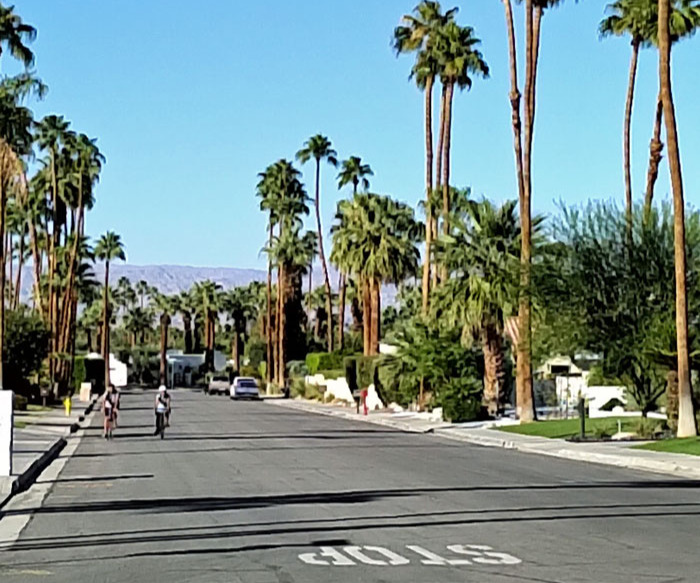
Residential Riding
Typical non-gated community street. This is in south Palm Springs.
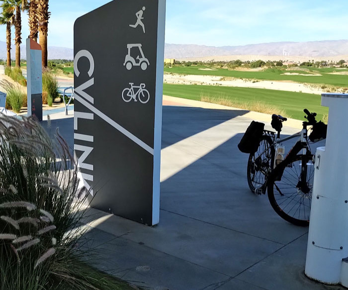
Paved Paths
CV Link will extend the entire length of the Coachella Valley when complete. Now available in Palm Springs (Vista Chino to Ramon and Tahquitz Creek) and Palm Desert in front of Triabike.
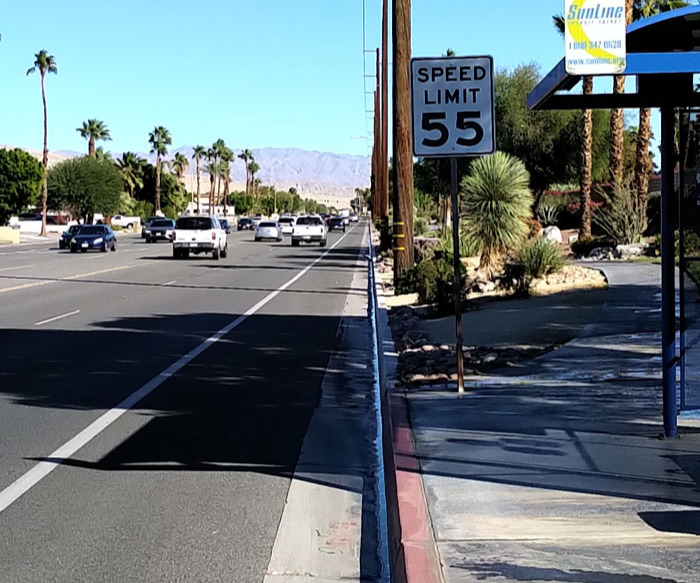
Bike Lanes
Every city in the valley has bike lanes. Link to the city bike maps we have posted. Note arterial roads have 45-55 MPH speed limits so be very visible and cautious of passing automobiles and trucks. We recommend mirrors and daytime lights for safe riding.
Ride with Us in the Coachella Valley
Meet in front if store at 10:30 on Saturdays for our weekly fun rides. All type of bikes welcome. (as of February 2024)
For intermediate and advanced road bike pavement riders we support the Desert Cycling Club that operates weekly rides on Tuesdays, Wednesdays, and Thursdays. Ride start time, length and location and varies with the season.
Here are some links to maps from the 2022 Tour de Palm Springs. You can choose to ride sections.
Be aware of vehicle traffic on these routes. Remember, you are a vehicle when riding so obey all signal lights and signs.
Tour de Palm Springs 52 mile route
Other Tour de Palm Springs Distances
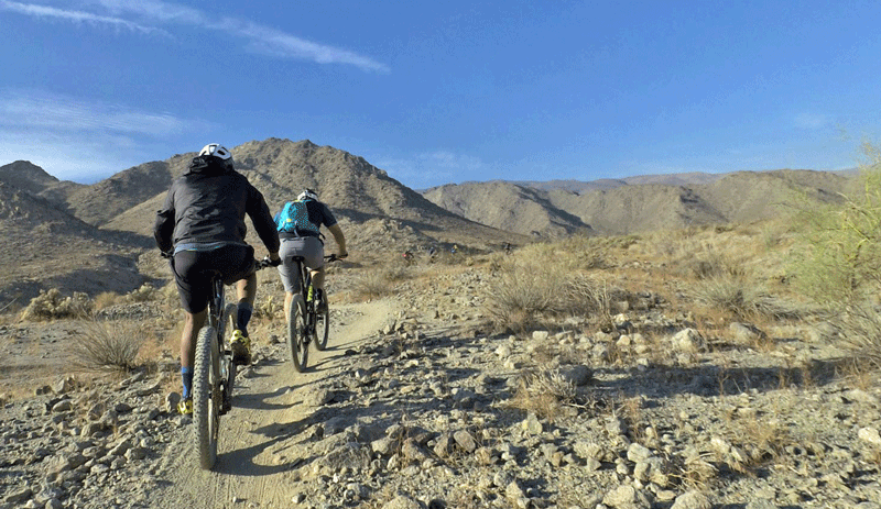
The Mountain Bike trails in the Palm Springs area are primarily technical rides as the surrounding mountain rise quickly from the valley floor. Riders skills need to be intermediate or advanced. Most rides require strong climbing skills. We do not recommend that you bring children or beginner riders on these routes. Recommended trail heads are at: LaQuinta Cove, Cathedral Cove Dunn Road (very steep climb access), "Goat Trails" at the East end of the Von's shopping center on Highway 111 in Palm Springs and on Highway 74 at the Santa Rosa and San Jacinto National Monument Visitor center.
For easy and beginner hard path and gravel road rides we recommend the Hemet Lake and Bear Mountain areas west of Palm Springs.
The base of La Quinta cove is loose gravel and quite flat so it is good for new mountain bikers. It is parallel to Calle Tecate in the city of LaQuinta near the Bear Creek Trail.
STREET RIDING MAPS
Most cities in the Coachella Valley produces street maps with bike lanes marked. These may be downloaded here:
LaQuinta
Indio
You may also search by city name at BIKEMAP.NET
or use Google Maps to plan your bike route
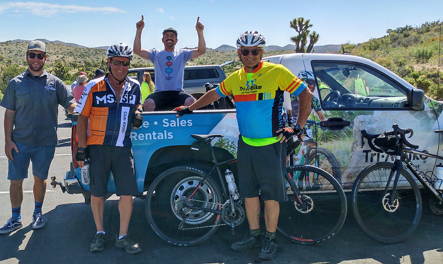
Some Rides from Tri-A-Bike
at 44841 San Pablo Avenue
North of Highway 111 or El Paseo - South of Fred Waring Drive
GPS 33.72283 latitude, -116.38280 longitude
Palm Desert/Rancho Mirage: Take me to The River Shopping Center In Rancho Mirage
This route is casual street touring ride, 5 miles long out and return that brings you to the River Shopping complex in Rancho Mirage. By adding side routes, you can increase the length to 8 miles. All distances are approximate.
Start at Triabike at 44841 San Pablo Ave. Parking is available on San Pablo, north in the Angelview parking lot or east of the shop on Alessandro Dr.
Head north on San Pablo, go .8 miles crossing Fred Waring.
Turn west at the College of the Desert parking entrance and go .15 miles
Turn left for another .15 miles
Turn west, go .25 miles
Head north (right) go .1 mile arrive at a circle.
Round circle head west towards Monterey .1 mile.
Cross Monterey, go 1.5 miles on Park View to Joshua Rd
Turn north go .3 miles to Magnesia Falls.
Ride West .4 miles to Magnesia Falls Plaza
Turn north (right) for 50 yards turn east and head to back of mall area to avoid vehicular traffic
Turn north at Cinder block wall and follow wall to Brandini’s Toffee.
Turn west toward Bob Hope Drive for about .2 miles
The River is on West at about 2.5 miles one way.
You can add distance by going west on Rancho which is .1 mile north of the Parkview Joshua Lane corner. There are 3 side streets off of Rancho that offer short back and out rides with interesting architecture and landscaping. To you can also head south on Joshua Lane instead of north at Park View.
- Difficulty - Easy Flat
- Link to details if applicable
Palm Desert: South of El Paseo (Shadow Mountain)
This riding area is an ungated community with many side streets filled with interesting homes and unique landscapes. You can vary the ride time and distance to your liking by staying in the Shadow Mountain area or head west on Fairway which is a flat ride out to Indian Wells on Fairview.
Head south from Triabike at 44841 San Pablo Ave approximately 1/4 miles and crossing Hwy 111 and El Paseo to Shadow Mountain Drive, be careful there is no bike route here, so an option may be on the sidewalk.
You can turn either east towards Portola and Indian Wells or west on Shadow Mountain. Heading west takes you up hill and you can cross Hwy 74 and ride west towards Desert Crossing Shopping center and Painters path
Alternately you can head east on Desert Lilly and ride in the Area to the east of Hwy 74. This is hillier area with interesting residential architecture and unique landscaping in this area.
Portola borders the East side of this area and leads to Indian Wells on Fairway.
- Difficulty - Easy Flat to Moderate
- Link to details if applicable
Palm Desert/Rancho Mirage: Gerald Ford/Tamarisk/Country Club Loop
This route is casual street touring ride, 14+ miles long loop ride The is a moderate uphill ride on Portola and on Gerald ford to Monterey. The bulk of the terrain is flat. It takes you through some ungated subdivisions with interesting architecture and landscaping. Once in the Tamarisk neighborhood you can ride a lot of alternate streets with limited traffic. You can also do this loop by parking at the Trojan Plaza starting at the end of the Abrams-Butler Trail. All distances are approximate.
Start at Triabike at 44841 San Pablo Ave. Parking is available on San Pablo, north in the Angelview parking lot or east of the shop on Alessandro Dr.
Head north on San Pablo for 1.2 miles to Magnesia Falls Dr.
Turn right and Ride .4 miles east to Portola Ave.
Turn north (left) onto the bike lane and ride for 3.3 miles to Gerald Ford Dr
Turn west and ride in the bike lane on Gerald Ford for 3 miles to Los Alamos across from the Westin Mission Hills Country Club entrance.
Turn south on Los Alamos and go .5 mile (You can add extra miles by riding around in the lovely community of modern and traditional homes.)
Turn East on Tamarisk go .2 mile
and then right onto Los Reyes Dr.
head south and then west at the corner and again south for .8 mile coming to Frank Sinatra.
You cross Sinatra and head south on Morningside for 1 mile.
Then turn south on DuVall for .45 mile to Michael Wolfson Park in Rancho Mirage
Go through park and ride south-east on Abrams Butler trail, go 1.2 miles
You come to Country Club and head east . 5 miles to Morningside
Turn north for 1.4 miles and this street turns into Thompson when crossing Sinatra.
Turn east on La Paz.go .3 miles road turns North as Los Reyes.
go .3 mile road turn west as Sunny.
Go .2 miles to Los alamos urn North (slight up hill .35 Miles to Gerald Ford.
Turn east back to Rancho Mirage shopping (.9 miles)or Lowes. 1.9 miles.
You may head east on Sinatra at Michael Wolfson Park to shorten you distance and rejoin the route at Sinatra and Morningside. This takes about 1.1 miles off the route.
- Difficulty - Easy
- Link to details if applicable
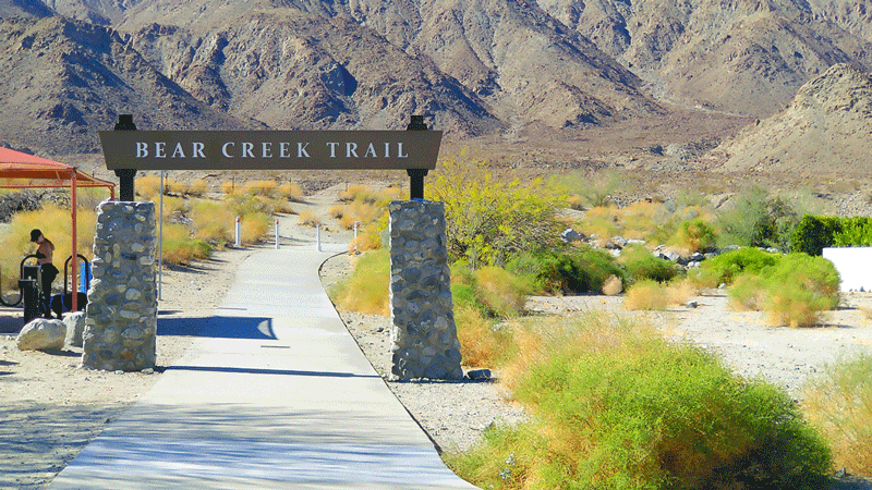
La Quinta: Bear Creek Trail
Bear Creek Path is a paved pathway that goes 4.8 miles along the base of the Southern Santa Rosa Mountains.
You can start at either end of Bear Creek, the north end is at the intersection of Eisenhower and Tampico and it starts up hill with the return ride down.
The South end starts at Calle Tecate and Avenida Madero, there is lots of parking at this end.
You can also add a .6 mile jaunt from the north end to go to the bike friendly Old Town Coffee shop at 78100 Main St, La Quinta,
- Difficulty Easy
- Link to details, if applicable
Palm Desert/La Quinta: 20 mile ride from Triabike to Old Town Coffee
Turn South on San Pablo from Triabike for .25 miles, crossing Hwy 111 and El Paseo and going to the T on Shadow Mtn Dr
Turn left onto Shadow Mtn Rd and cross Portola about .5 miles
Do a slight right on Candlewood. Turn right on to Panorama go .25 miles
Then turn left on Fairview Dr and go 2 miles
Turn left onto Indian Wells Ln go about .5 miles to a gate by a hotel. Go through the parking lot and turn right on Hwy 111.
Stay on pathway for approximately 2.25 miles and go right behind the Vons on the back parking lot.
Go right on sidewalk at Washington go south about 1.5 miles.
Turn Right at Happy Point Way go about 50 yards and turn left onto the Singing Point and then another left on to a residential street Cameo Palm Drive.
Follow the drive to T, turn left and then a right on to service road past Catholic Church,
get back on to sidewalk and ride 1.25 miles to Eisenhower.
Turn Right on Eisenhower and follow past curve and Past Waldorf Astoria about 1.5 miles to Calle Tampico.
Turn Left onto Tampico and go east about .6 miles to Old Town Shopping area and turn right.
Old Town Coffee is about 50 yards on the left.
- Difficulty - Easy
- Link to details if applicable
Mecca Box Canyon: Scenic Ride
19.5 miles one way for shuttle or 39 mile return ride. Route has 1590 ft. elevation gain. Start at 66 Ave and Johnson Rd ride to Pinto Road Indio.
- Difficulty – advanced, climb to turnaround or shuttle pick up at Pinto Rd and I-10.
- Link to details if applicable
Trails
La Quinta: Cove to the Lake Trail
- 7 miles out and back.
- Start at the parking lot south on Intersection of Avenida Ramirez and Calle Tecate.
- Difficulty- moderate
La Quinta: Boo Hoff Trail
- 6 miles loop
- Single track
- Start at off Eisenhower
- Difficulty- advanced
Palm Desert: Art Smith Trail
- 9 miles out and back
- single track
- Difficulty- advanced
Palm Desert:Bump & Grind
- 3 miles one way
- Single track
- Difficulty – advanced
Palm Desert:Hop Along Cassidy
- 11 miles out and back
- Single track
- Start at tennis courts on west side of Lake Cahullia County Park, At the junction of Cahuilla Park Road and Jefferson St
- Difficulty – advanced
Cathedral City: Dunn Road Hahn Trail
- 17 mile loop
- Single track
- Difficulty – advanced
Palm Springs: The Goat Trails
- 10 miles out and back
- Many networked trails in area
- Single track
- Start is at the Rimrock shopping mall at the corner of East Canyon Dr and Palm Hills Rd.
- Difficulty – Advanced
Palm Springs: Palm Canyon Epic
- 28 miles out one way to Pinyon, this is a shuttle ride
- Single track
- Start is at the Rimrock shopping mall at the corner of East Canyon Dr and Palm Hills Rd
- Difficulty – advanced much climbing.
Joshua Tree National Park
- Various distances – 29 miles of gravel roads
- Various start points
- 40 miles east of Palm Desert on Interstate 10.
- Difficulty- easy to moderate
Hemet: Diamond Valley Lake Trail
- 21 mile loop paved and graveled around Diamond Lake
- Starts at the Diamond Lake visitor center 2325 Searl Pkwy, Hemet
- Difficulty easy with moderate hills.
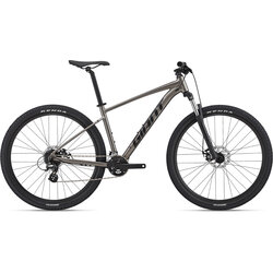
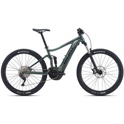
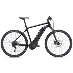
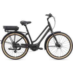
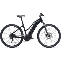
Get the Gear You Need
Shop for the perfect bike before your next ride. We’re here to answer all of your cycling related questions.